


Hopkins County Weather Forecast for August 4th, 2020

[adning id=”33097″]
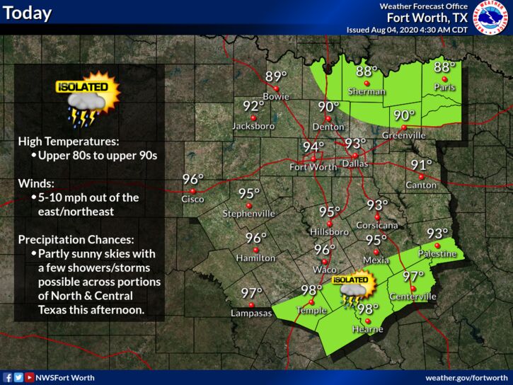
A few showers and storms will once again be possible today across portions of North and Central Texas. Afternoon showers/storms may develop along a remnant boundary in Central Texas. Meanwhile, precipitation across Oklahoma may move southeastward, affecting areas east of I-35 and north of I-30. No severe weather is expected.
[adning id=”33207″]
Today
Sunny, with a high near 88. North northeast wind around 5 mph.
Tonight
A 50 percent chance of showers and thunderstorms after 4am. Increasing clouds, with a low around 69. East wind around 5 mph. New rainfall amounts of less than a tenth of an inch, except higher amounts possible in thunderstorms.
Wednesday
Showers and thunderstorms likely, mainly before 10am. Partly sunny, with a high near 87. East southeast wind around 5 mph. Chance of precipitation is 60%. New rainfall amounts between a half and three quarters of an inch possible.
Wednesday Night
A 30 percent chance of showers and thunderstorms after 1am. Partly cloudy, with a low around 70. East southeast wind around 5 mph.
Thursday
Partly sunny, with a high near 92. South southeast wind 5 to 10 mph.
Thursday Night
Mostly clear, with a low around 76. Southeast wind around 10 mph.
Friday
Mostly sunny, with a high near 96. South southwest wind 5 to 10 mph.
Friday Night
Mostly clear, with a low around 75. South wind 5 to 10 mph.
Saturday
Sunny, with a high near 97. South southeast wind 5 to 10 mph.
Saturday Night
Mostly clear, with a low around 77.
Sunday
Sunny, with a high near 96.
Sunday Night
Mostly clear, with a low around 77.
Monday
Sunny, with a high near 97.
[adning id=”33207″]