


National Weather Service Includes Hopkins County in Hazardous Weather Outlook for Next 7 Days

[adning id=”33097″]
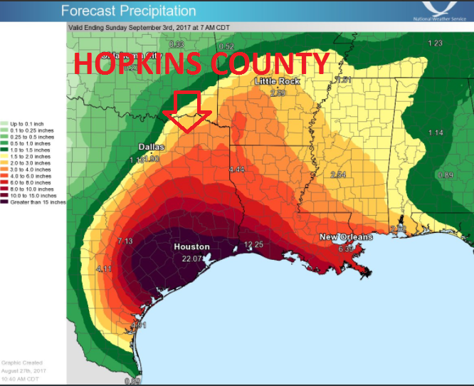
(Forecast Precipitation until 7AM Sunday September 3rd.)
This Hazardous Weather Outlook is for North and Central Texas.
.DAY ONE…Today and Tonight.
Widespread rain and isolated thunderstorms will occur today southeast of a Lampasas to Waco to Athens line where a Flash Flood Watch remains in effect. Rain chances decrease the farther north you go
but isolated thunderstorms and periods of moderate to heavy rainfall that could lead to localized flooding will be possible.
.DAYS TWO THROUGH SEVEN…Monday through Saturday. Rain and isolated thunderstorms are expected on Monday with the best rain chances generally south of Interstate 20. The remainder of the week will be unsettled with rain and thunderstorm chances continuing. The primary hazard will be from heavy rainfall which could result in flooding. The most favored location and timeframe for the heavy rainfall will be dependent on where Tropical Storm Harvey moves in the coming days.
[adning id=”33207″]
[adning id=”33207″]